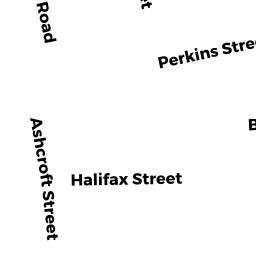
365 S HUNTINGTON AV
Owner Information
ELIAS ABEBE
365 S HUNTINGTON AV
BOSTON, MA 02130


Property Details
365 S HUNTINGTON AV is classified as a Single Family Residential (Colonial).
The primary structure on this property was built in 1910. There is 1,776ft2 of residential/living space within this property. This property is listed as having 8 rooms.
365 S HUNTINGTON AV is valued at $721,700. The land is valued at $240,900 and the structures are valued at $480,800.
The most recent deed for 365 S HUNTINGTON AV is recorded at the local registrar in Book 21659, Page 037. 365 S HUNTINGTON AV was last sold on Wednesday, August 20, 1997 for $187,000.
Assessment data from fiscal year 2020.
Flood Data
According to the FEMA National Flood Hazard Layer, this property does not appear to be in a flood zone. It may also be in an area not yet reviewed. Nonetheless, confirm this information prior to taking any action.
To view the flood hazards around this property, create a FEMA "Firmette" Map of the area around 365 S HUNTINGTON AV.
Broadband Internet Providers
| Provider | Type | Bandwidth (mbps) | |
|---|---|---|---|
| Viasat Inc | Satellite | 100 | 3 |
| Verizon New England Inc. | Fiber | 940 | 880 |
| Comcast | Cable | 1000 | 35 |
| Starry, Inc. | Fixed Wireless | 200 | 200 |
| netBlazr Inc | Fixed Wireless | 50 | 50 |
| T-Mobile | Fixed Wireless | 25 | 3 |
| GCI Communication Corp. | Satellite | 0 | 0 |
| HughesNet | Satellite | 25 | 3 |
| VSAT Systems, LLC. | Satellite | 2 | 1 |
| Verizon New England Inc. | DSL | 5 | 0 |
Broadband service provider data from December 2020.
Adjacent Properties
- 15 Zamora ST
Two-Family Residential owned by WASHINGTON DAVID R TS - S HUNTINGTON AV
Undevelopable Residential Land owned by ELIAS ABEBE - 363 S HUNTINGTON AV 1
Residential Condominium owned by SNIDER JASON - 363 S HUNTINGTON AV 3
Residential Condominium owned by NAVEDO DEBORAH D - 363 S HUNTINGTON AV 4
Residential Condominium owned by ENUMAH SAMUEL JOSEPH - 363 S HUNTINGTON AV 5
Residential Condominium owned by DORMAN RINALDO - 363 S HUNTINGTON AV 2
Residential Condominium owned by BUNNELL BRUCE - 363 S HUNTINGTON AV
Other, Open Space owned by THREE 63 S HUNTINGTON AVE - ZAMORA ST
Undevelopable Residential Land owned by WASHINGTON DAVID R TS